

Published on: 12/16/2025
This news was posted by Oregon Today News

Description
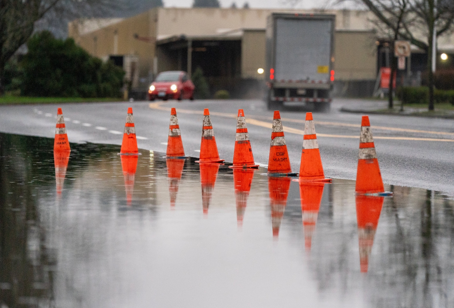
A series of storms, including a strong atmospheric river, will move through the Pacific Northwest again this week. Forecasters with the National Weather Service said Tuesday the storms could bring more rain, gusty winds and thunderstorms.
The weather service has issued a flood watch for much of the region starting Wednesday night through late Friday. That means flooding is possible, but not necessarily imminent.
A potent atmospheric river event will cause periods of heavy rain Tuesday through Saturday, leading to the potential for river flooding as well as flooding of urban areas and small streams. Now is the time to prepare! Visit https://t.co/hk5GIqvtFp for more info. pic.twitter.com/tG4orrouRr
— NWS Portland (@NWSPortland) December 16, 2025
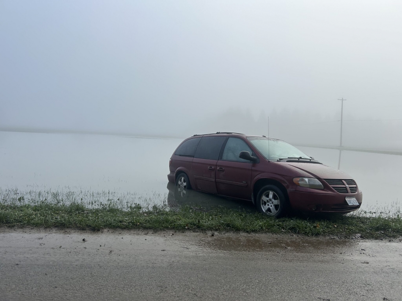
This is the second atmospheric river — basically, a conveyor belt of moisture in the sky — to douse the region in the last two weeks. Weather officials worry rivers and streams could overflow into roads, triggering flooding and landslides.
“If you come across a flooded road, flooded walkway or just flood waters in general, we recommend that you turn around,” said David Bishop, National Weather Service meteorologist. “Don’t drown. It is not worth anything to cross a flooded road because you don’t know what the road looks like underneath that water.”
Strong winds might bring down powerlines. Bishop warned people to assume all downed power lines are live and to call emergency officials.
Bishop said it’s difficult to predict which regions are most at risk of flooding, but predictive weather data gives some indication.

“In general, the heaviest rain is most likely to end up between Clark County and Douglas County, with the highest confidence across Lane, Lincoln, Benton and Linn counties,” Bishop said.
According to Bishop, areas in the Willamette Valley could potentially see up to 4 inches of rainfall between Wednesday and Friday. People on the Oregon Coast, especially those living in Tillamook and Lincoln City, could see up to 5 inches of rain during that timeframe.
“And then to top it off … we do also have a 15 to 30% probability of thunderstorms,” Bishop said. Those isolated thunderstorms are possible Tuesday in the northern and central Oregon Cascades and South Washington Cascade Foothills, as well as along the Oregon Coast.
Highway remains closed after massive landslide near the coast
Coastal areas are still dealing with the aftermath of an earlier atmospheric river that doused the region last week.
Flooding triggered a landslide near Siletz late last week, blocking the town’s main route along Highway 229 to Lincoln City.

Oregon Department of Transportation officials say they expect the highway to remain closed at least through this week.
“The massive amount of earth that has moved is still settling,” said ODOT spokesperson Mindy McCartt. “We haven’t seen any more slide activity, but when you’re out there, you can hear trees snapping in the distance.”
The landslide is also blocking road access for members of the Confederated Tribes of Siletz Indians. The tribes own multiple offices and properties between Siletz and Lincoln City.
“That’s been a huge impact to us,” said Angela Sondenaa, the tribes’ natural resources director. “We have other slides along near Siletz on the upper Siletz River that’s also impacting access to our tribal properties.”
Sondenaa is also concerned about debris falling into the river, increasing sediment and potentially harming salmon runs.
“It smothers spawning beds,” Sondenaa said. “It impacts water quality for fish and other aquatic life.”
Rain, snow reach far across the region
Also potentially on the way is snow in the Cascades. Snow is most likely on Friday, but as of Tuesday, forecasters said it was still hard to predict how much might fall.
Meanwhile, northwestern Washington continues to get pummeled by rain from a separate storm.
Around 1,300 people are under precautionary evacuation orders after two levees failed on Tuesday morning. At least one person has died in flash flooding.
Bishop said the region around Seattle is also bracing for another bout of rain this week. Across the Northwest, he said, it’s a good time to prepare and take precautions as storms bring “a lot of chaos to the area” if they happen.
With the ground saturated by rain, strong winds could topple trees or powerlines, and more roadways could flood.
“It is not over,” Bishop said.
News Source : https://www.opb.org/article/2025/12/16/oregon-weather-forecast-siletz-atmospheric-river-pacific-northwest/
Other Related News

12/16/2025
Oregons farmworker union is calling on the states residents to protest the Trump administr...
12/16/2025
The region is experiencing unusually warm and dry conditions scientists find and snowpack ...

12/16/2025
Authorities have released a new video timeline and a slightly clearer image of the man sus...

12/16/2025
A witness reported that ICE agents fired chemical munitions at protesters out the window o...
12/16/2025
Portland is facing another challenging budget year according to city economists According ...
Follow

Download Our App


Copyright 2022 © EPUERTO. All Rights Reserved