

Published on: 05/23/2026
This news was posted by Oregon Today News

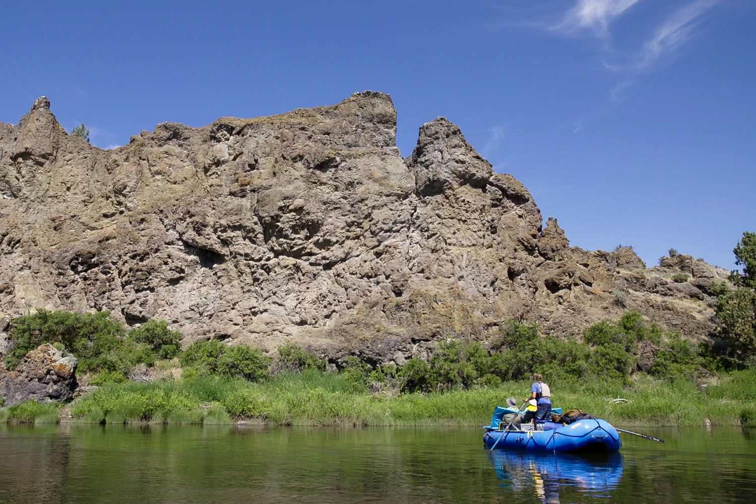
Description
The John Day River flows some 284 miles from its source in northeastern Oregon to its confluence with the Columbia east of Arlington. On that journey, it travels through some of the most distinct and scenic landscapes in Oregon.
Along 48 river miles in Wheeler and Wasco counties, the John Day canyon cuts through three distinct rock formation types to reveal a three-dimensional view of a major transition in Oregon’s geologic history.
“Oregon Field Guide” learned this first-hand during a geology-focused rafting trip down this section of the John Day last June. Our guide was Ian Madin, former chief scientist for the Oregon Department of Geology and Mineral Industries. As we traveled downstream, he explained the 40 million years of geologic history that shaped the surrounding area.

The top and most recent layer of the landscape is made up of deep beds of Columbia River Basalt, Madin said. This common rock is the result of a series of volcanic fissures that released hundreds of basalt lava flows about 16 million years ago. For about a million years, the successive floods of basalt piled one on top of the other, creating layers visible in the exposed rock throughout eastern Oregon and Washington.
“In a geologic instant, these great outpourings of basalt flooded all of eastern Oregon and eastern Washington with thousands of feet of black basalt. The resulting landscape would have been … you know, the plains of Mordor. Black, bare lava,” Madin said.
As rivers like the John Day cut through this new landscape over millennia, the layers of the various flows became clearly visible in the canyon walls.
Partway down the river, Madin points out two other types of older rock. These rocks date back to volcanic events that occurred fairly consistently beginning about 40 million years ago, he said.

One type is characterized by smooth-looking hills made up of billions of tons of hot ash that spewed from supervolcanoes.
“There were many, many huge caldera explosions that threw billions of tons of hot ash and pumice into the sky which rained down on the surrounding landscape and built up layer upon layer of volcanic rock called tuff,” Madin said.
Known as the John Day formation, these hills feature landscape striped with colorful bands. From the raft, they provide a hauntingly beautiful contrast to the craggy Columbia River Basalt. Oregon’s Painted Hills are a well-known example of this striped formation.
At the same time as the super volcanoes that created the John Day formation were spewing ash across the region, smaller volcanoes were also erupting. The lava produced by these more local events intermingled with the wide-spread ash to create a hodgepodge of landscape types, known as the Clarno formation. Clarno features are often visible side-by-side with the John Day formation from the river.

“The Clarno is a complicated collection of lava flows that may have been cut by a river that produced a canyon that was then filled by a mud flow and another lava flow was on top of that,” Madin said. “And then hot water pumped through the entire thing and painted it green and purple and made it into a hot mess and then the whole cycle started over again. So the rocks of the Clarno formation are messy.”
Over millions of years, these “messy” mountains were impacted by myriad forces to form irregular shapes that suggest piles of broken bricks and cobbles. The complexity of the formation can leave even seasoned geologists like Madin perplexed.
“There’s a lot of places where you just can’t tell what they are. You can go up and bang on them with a hammer and you still have no idea what they are. It’s very challenging, but it’s also very interesting to try to unravel those mysteries.”
The geology-focused rafting trip traversed almost 48 miles over four days and three nights of camping riverside, with about a dozen people enjoying the sights of spectacular geologic formations along the shore.
Through observations and deep knowledge of the forces that shape the geology around us, Madin read the landscape, offering insight and perspectives that can only be appreciated from the river.
“One of the great things about floating this river is it’s a window into this really complicated landscape that most of the time we’re just walking around on the surface and we never get to see the third dimension, and this gives us that view,” he said.
“Two of the things I love most in the world are floating down rivers and talking about geology, so the opportunity to do both of those things at the same time is kind of my idea of heaven.”
News Source : https://www.opb.org/article/2026/05/23/oregon-geologist-floats-john-day-river-40-million-years-rock/
Other Related News

05/23/2026
Q My doctor prescribed hormones due to bone loss I am using an estrogen patch progesterone...
05/23/2026
The Portland Fire are on their second of three games in this week-long road trip and take ...
05/23/2026
The Dyson Airwrap id is back at the center of the internets beauty conversation and for go...
05/23/2026
What happens when an avid hiker and a long-distance runner tackle the same grueling mounta...
05/23/2026
DEAR MISS MANNERS Years ago a close friend of mine was getting married As I am known as a ...
Follow

Download Our App


Copyright 2022 © EPUERTO. All Rights Reserved