

Published on: 04/13/2026
This news was posted by Oregon Today News

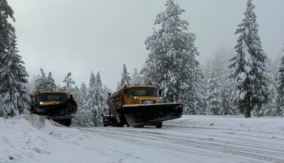
Description

A winter storm warning is in place for heavy snow in the Oregon and Washington Cascades from 5 p.m Tuesday through 5 a.m. Thursday.
The National Weather Service is warning that between 12 and 20 inches of snow could fall at areas above 2,500 feet during that 36-hour stretch. Wind gusts could be as high as 45 mph.
There’s also a slight chance for wet snow at elevations as low as 1,000 feet.
NWS officials are asking people to postpone travel over the Cascade passes until weather conditions improve. They also advise people to avoid backcountry recreation as the storm moves through.
As of early Monday afternoon, forecasters said the heaviest snow is expected in Marion and Lane counties.
Heavy snow is forecast over the Cascades Tuesday night through Wednesday night. The heaviest snow is expected late Tuesday night into Wednesday morning. Travel over the Cascades will be hazardous. Prepare now for these conditions if you have mountain travel plans! pic.twitter.com/T79Xy4cyby
— NWS Portland (@NWSPortland) April 13, 2026
According to the NWS area forecast discussion, clearer and cooler conditions could move in Thursday. But that would again bring frost concerns for much of northwestern Oregon.
Temperatures are expected to gradually warm this weekend.
News Source : https://www.opb.org/article/2026/04/13/winter-storm-warning-snow-cascades/
Other Related News

04/18/2026
DEAR ABBY How should I handle in-laws who show up three or more hours early for dinner and...

04/18/2026
Dear Eric I am struggling with my mother

04/18/2026
On Friday friends and family of Hailey Athay gathered to remember her life a year and a ha...

04/18/2026
Portland Mayor Keith Wilson expressed optimism tempered by fiscal reality in his second St...

04/18/2026
PORTLAND Ore KOIN An Eastern Oregon man was arrested this week after a 15-year-old report...
Follow

Download Our App


Copyright 2022 © EPUERTO. All Rights Reserved