

Published on: 02/15/2026
This news was posted by Oregon Today News

Description

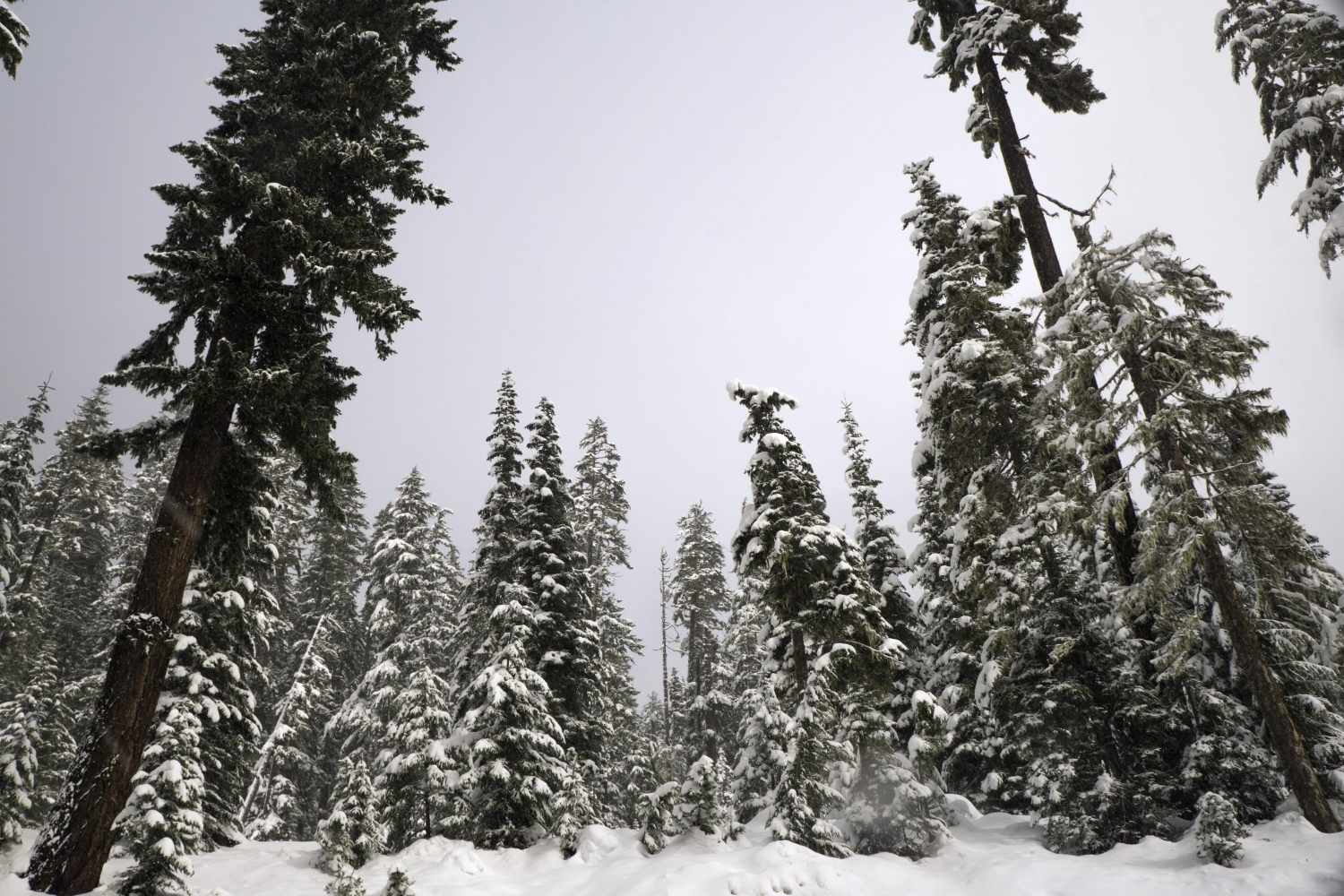
Weather forecasters expect that days of snowstorms beginning Monday will make mountain passes treacherous in southern Washington and north-central Oregon.
The National Weather Service has issued a winter weather advisory in effect early Monday through early Thursday.
The advisory warns of possible snow accumulations of 4 to 8 inches on Monday, with another 2 to 5 inches on Tuesday, then 4 to 9 inches throughout Wednesday.
The forecast is a late-season respite from an unusually dry winter that’s plunged Oregon’s average statewide snowpack to historically low levels, fueling worries about water availability and increased risks of wildfire in the warmer months ahead.
This week, high-elevation bridges and overpasses are expected to be especially hazardous in areas like Willamette Pass, Bennett Pass, Tombstone Summit, Breitenbush Springs, McKenzie Pass, Government Camp, Santiam Pass and Mt. St. Helens.
Forecasters urged travelers who can’t delay their plans to be prepared for slippery roads and have a winter emergency driving kit on hand with items like a flashlight, batteries, blankets, a shovel, food, water and tire chains.
Lower elevations in the Willamette Valley could also see snow this week, as weather systems from the north bring in cold air.
“If any lowland snow accumulates, it will be short-lived as daytime temperatures will rise well above freezing,” the National Weather Service in Portland predicted.
News Source : https://www.opb.org/article/2026/02/15/snow-dumps-in-store-for-cascade-passes/
Other Related News

02/15/2026
Oregon snowboarder Sean FitzSimons competed in the race at Livigno Snow Park early Sunday ...
02/15/2026
PORTLAND Ore KOIN The National Weather Service Portland office has issued a Winter Weathe...

02/15/2026
Dear Annie From the outside my life looks like the kind of before photo people put in grat...

02/15/2026
Josh Proctors first career hit will be remembered for a while
02/15/2026
An anonymous post in a local Facebook group has inspired Milwaukie residents to claim an u...
Follow

Download Our App


Copyright 2022 © EPUERTO. All Rights Reserved