

Published on: 08/10/2025
This news was posted by Oregon Today News

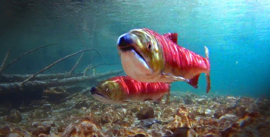
Description

When waters get too warm, they can harm or even kill salmon. The problem is expected to get worse as the climate continues to change.
Now, researchers are using data from NASA satellites to help.
Using satellite remote sensing to measure water temperature has been heavily underutilized, said Faisal Hossain, a professor at the University of Washington Department of Civil Environmental Engineering. He said that’s often because there’s a lack of access to the data or an easy way to package it.
Now, UW graduate student George Darkwah is changing that. Darkwah developed an open-source tool and website, called Thermal History of Regulated Rivers, or THORR.
THORR uses artificial intelligence to interpret all that temperature data from NASA’s Landsat satellites, dating back decades. It allows people to better understand river temperatures over time, Darkwah said.
“The idea is to utilize this untapped data on not just our (water) management techniques, but on very diverse areas within the environmental ecosystem here on Earth,” Darkwah said.
Hot salmon: Heat wave brings concern over river-water temperatures
Without THORR converting the data to something usable, the results could be patchy, Hossain said. There could be clouds. Rivers are narrow. That makes it hard for the satellite to see.
“When (the satellite) was first launched, land surface was the focus, not really water. … You run into all kinds of complications,” he said.
THORR helps fill those gaps, giving a comprehensive account of river temperatures, Hossain said.
“(Darkwah’s) work has extended the value of Landsat beyond land to water on the land,” he said.
However, the high-tech isn’t replacing the old. Darkwah said he views it as a complement to traditional, on-site water temperature gauges.
“It can also be applied or extended to areas that do not even have existing water temperature measurements,” Darkwah said.
Like in his home country of Ghana. Darkwah said he was surprised at the amount of scientific data available here in the United States.
“I’m like baffled about the amount of data, but then to be able to also use it in a country like mine where there isn’t any data for me to rely on (could be helpful),” Darkwah said.
The satellite data he’s using covers the entire world, giving the tool a global reach, he said.
But Darkwah said he didn’t want THORR to be stuck in the dusty halls of academia. He designed it so that people developing river policies or management strategies could easily use the information “for the benefit of everyone.”
“Based on that knowledge, we can modify how we operate water in the future,” Darkwah said.
Underwater video shows heat-stressed salmon, but it could have been worse
While developing the tool, he worked with the Columbia River Inter-Tribal Fish Commission, or CRITFC, to fact check the on-the-ground data and THORR’s usability. In a news release, CRITFC leaders said the tool could be used to help manage salmon.
“It’s imperative that we understand what’s happening in the Columbia River, the water temperature, because the fish have lethal limits,” said Elaine Harvey, CRITFC’s watershed department manager, in the news release.
British Columbia has also expressed interest in the tool, Hossain said.
There are lots of ways to use THORR, the researchers said. They hope it could help inform managers of the best times to release or spill water over the tops of dams to help fish.
In addition, it could help look for patterns, like with cyanobacteria blooms, commonly known as algal blooms, or temperature fluctuations near data centers, Darkwah said.
Courtney Flatt is a reporter with Northwest Public Broadcasting. This story comes to you from the Northwest News Network, a collaboration between public media organizations in Oregon and Washington.
It is part of OPB’s broader effort to ensure that everyone in our region has access to quality journalism that informs, entertains and enriches their lives. To learn more, visit our journalism partnerships page.
News Source : https://www.opb.org/article/2025/08/10/nasa-satellites-northwest-river-temperatures/
Other Related News

08/12/2025
CORVALLIS Its hot Especially on artificial turf
08/12/2025
On Tuesday at 120 pm the National Weather Service issued an extreme heat warning in effect...
08/12/2025
An Albany man was sentenced Tuesday to 42 years in federal prison for sexually abusing a t...
08/12/2025
Flooding from the basin has become an annual concern and in recent years has swept away ho...
08/12/2025
Portlands Tom McCall Waterfront Park will once again be transformed into a skatepark this ...
Follow

Download Our App


Copyright 2022 © EPUERTO. All Rights Reserved